
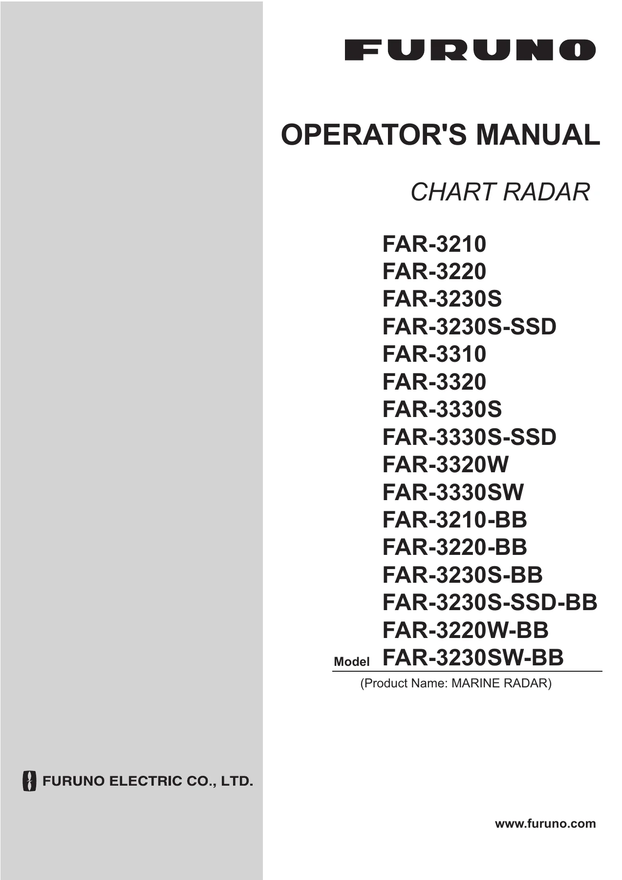
Furuno FAR-3000 Series Chart Radar Operator’s Manual OME-36160-B2 – FAR-3210 FAR-3220 FAR-3230S FAR-3310 FAR-3320 FAR-3330S PDF
Original price was: $69.95.$49.95Current price is: $49.95.
Complete operator’s manual for Furuno FAR-3000 series chart radar systems. Covers operation, target tracking, AIS, chart management, route planning, alerts and maintenance for all FAR-32×0 and FAR-33×0 models including BB variants.
Description
Furuno FAR-3000 Series Chart Radar Operator’s Manual OME-36160-B2
This is the complete operator’s manual for the FURUNO FAR-3000 series marine chart radar systems, document number OME-36160-B2. It covers the full range of FAR-32×0 and FAR-33×0 models, including X-band and S-band variants, magnetron and solid-state configurations, and all black-box (BB) versions. Whether you operate a FAR-3210, FAR-3220, FAR-3230S, FAR-3310, FAR-3320, FAR-3330S, FAR-3320W, or FAR-3330SW, this manual provides the operational procedures, system descriptions, and configuration guidance you need to run the equipment correctly.
File Details
- Manual type: Operator’s Manual
- Brand: FURUNO
- Models covered: FAR-3210, FAR-3220, FAR-3230S, FAR-3230S-SSD, FAR-3310, FAR-3320, FAR-3330S, FAR-3330S-SSD, FAR-3320W, FAR-3330SW, FAR-3210-BB, FAR-3220-BB, FAR-3230S-BB, FAR-3230S-SSD-BB, FAR-3220W-BB, FAR-3230SW-BB
- Document number: OME-36160-B2
- Language: English
- Page count: 463
- File format: PDF
Chapters Covered
- 1. Operational Overview
- 2. Radar, Chart Radar Operation
- 3. Target Tracking (TT)
- 4. AIS Operation
- 5. Radar Map and Track
- 6. Chart Overview
- 7. How to Manage Charts
- 8. How to Control Chart Objects
- 9. Vector (S57) Charts
- 10. C-MAP Charts
- 11. Chart Alerts
- 12. Routes
- 13. User Charts
- 14. How to Monitor Routes
- 15. Navigation Tools
- 16. Navigation Sensors
- 17. AIS Safety, NAVTEX Messages
- 18. TT and AIS Displays
- 19. Recording Functions
- 20. Alerts
- 21. Parameters
- 22. Settings Menu
- 23. Common Reference System
- 24. Maintenance and Troubleshooting
Operational Overview and Radar/Chart Radar Operation (Chapters 1–2)
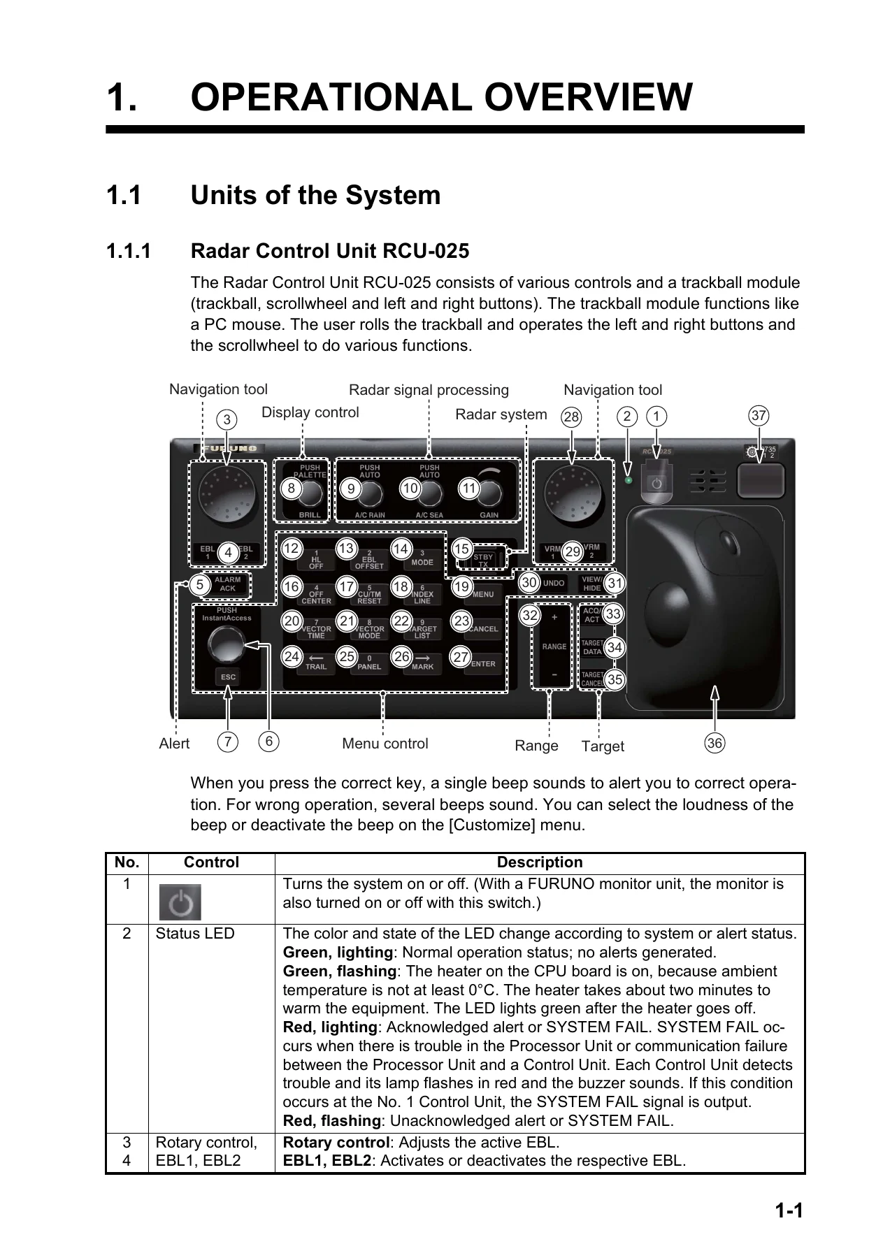
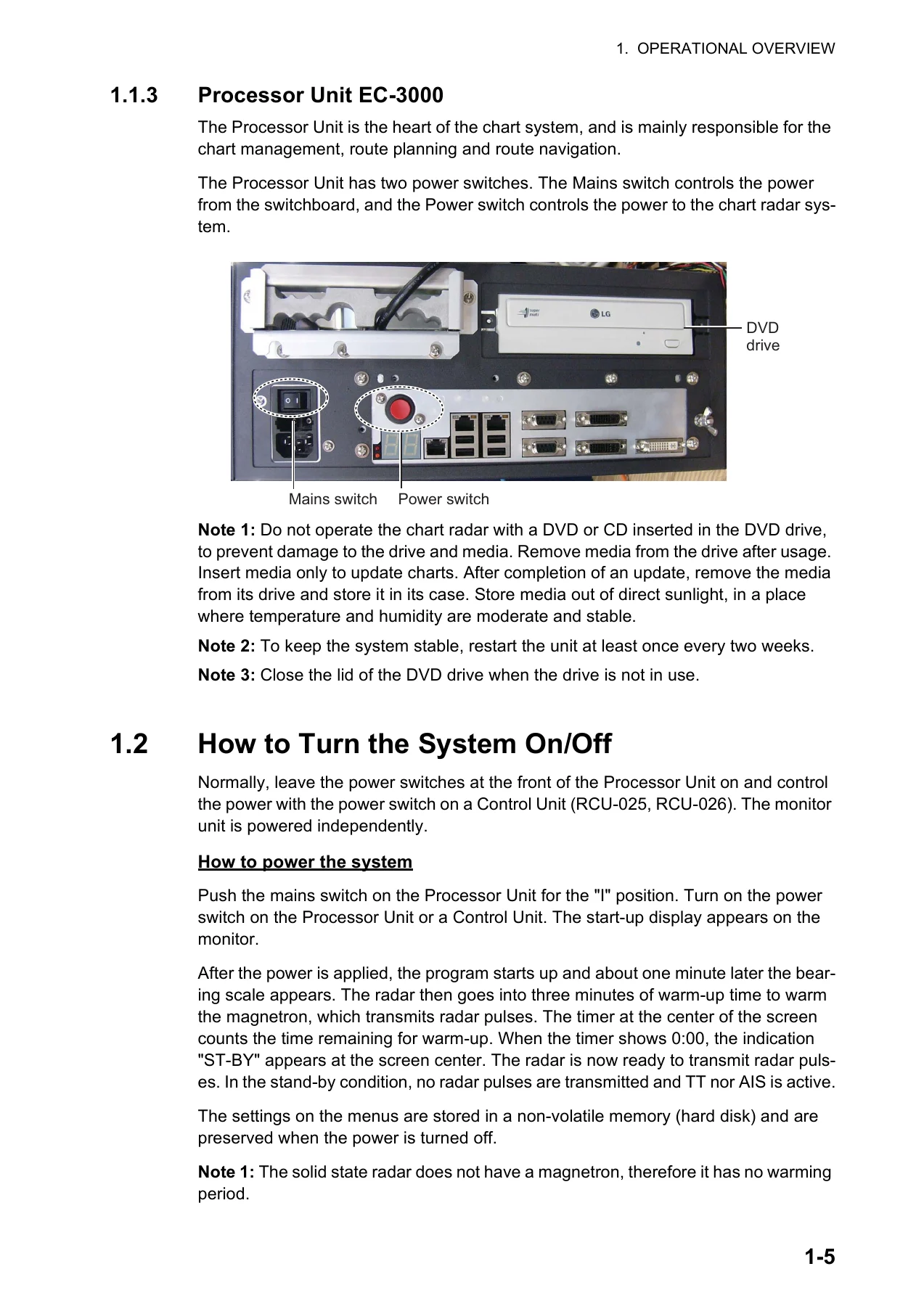
Chapter 1 walks through the system layout, including the Radar Control Unit RCU-025, Trackball Control Unit RCU-026, and Processor Unit EC-3000. It covers power-up and shutdown, color palette selection, display brilliance adjustment, operating modes, screen layout, the status bar and InstantAccess bar, sensor information, menu operation, context-sensitive menus, cursor position, sensor settings, ship speed and heading input, MOB marking, position offset, time format, screenshots, user profiles, and operational tips. Chapter 2 is the core operating reference: transmitting, tuning the magnetron radar, pulse length selection, sensitivity adjustment, sea and rain clutter suppression (manual and automatic), interference rejection, echo stretch, echo averaging, Automatic Clutter Elimination (ACE), noise rejection, wiper, customized echo presets, second-trace echo suppression, presentation modes, range scale selection, range and bearing measurement with VRM and EBL, offset EBL for collision assessment, range/bearing between two targets, off-centering, target trails, parallel index lines, zoom, markers, screen data brilliance, watch alert, information box, interswitch, dual radar, performance monitor, magnetron reset, CCRP, drop marks, anchor watch, SART reception, alert box and list, echo area and color, icing prevention, chart radar functions, and radar observation principles including false echoes and RACON.
Target Tracking and AIS (Chapters 3–4)
Chapter 3 explains the Tracked Target (TT) system: showing and hiding TT displays, speed input including echo-referenced speed, automatic and manual acquisition, setting acquisition zones, stopping tracking, TT symbols and their attributes, displaying target data, vector modes and lengths, past position display, set and drift input, CPA/TCPA alarms, lost target alerts, trial maneuvers (static and dynamic), TT simulation mode, TT alerts, criteria for selecting targets, and factors affecting tracking accuracy. Chapter 4 covers AIS operation: deactivating the AIS function, showing and hiding AIS targets, AIS symbols, filtering sleeping targets, activating and sleeping targets, displaying basic and expanded AIS target data, AIS CPA/TCPA alarms, symbol brilliance and color, lost AIS targets, past positions, true/relative speed vectors, association of TT and AIS targets, voyage data entry, and AIS messaging including creating, transmitting, and receiving messages.
Radar Map, Track, and Chart Fundamentals (Chapters 5–6)
Chapter 5 describes the radar map function: creating and displaying marks and lines, finding map point usage, selecting maps, attaching comments, erasing and copying marks and lines, exporting and importing radar maps, showing/hiding radar map features, setting up ship’s track, erasing track, route display, and user chart display. Chapter 6 provides a thorough overview of the chart screen, including the electronic chart area, status bar, InstantAccess bar, sensor information box, own ship functions box, route information box, Overlay/NAV Tools box, alert box, permanent warning box, EBL/VRM boxes, context-sensitive menus, alphanumeric data entry, operating mode selection, chart operating mode selection, chart scale selection, presentation mode selection, cursor position box, standby mode, true motion reset, route and user chart control, VRM/EBL usage, split screen (not available), datum, sensor settings, ship speed and heading input, and pre-departure setup procedures.
Chart Management and Chart Objects (Chapters 7–10)
Chapter 7 covers chart management: installing public keys for ENC charts, installing ENC licenses and charts, deleting ENC licenses, installing C-MAP charts (including eToken registration and database installation), deleting C-MAP databases, installing C-MAP DL charts, exporting chart and license lists, showing ENC permits, backing up and restoring licenses, viewing permit expiration dates, displaying install/update history, catalog of chart cells (grouping, status), opening charts, printing chart and cell status lists, deleting charts, showing publishers notes, finding chart type, manual updates for ENC and C-MAP charts (inserting, deleting, modifying update symbols), synchronizing chart data, and reconverting SENC charts. Chapter 8 explains chart object control: browsing charts, setting shallow contour, safety depth, safety contour and deep contour, basic setting menu, chart display menu, display base, controlling visibility of symbols and features (General, Tracking, Route, Mariner, Targets pages), and predefined IMO chart display settings. Chapter 9 covers vector (S57) charts: definitions, chart legend, permanent warnings, chart viewing dates and seasonal features, symbology, finding S57 chart object information, and the Admiralty Information Overlay (AIO). Chapter 10 covers C-MAP charts: cartographic service, system registration, ordering charts, applying for licenses, troubleshooting, subscription services, chart display, and permanent warnings.
Routes, Navigation, and Chart Alerts (Chapters 11–16)
Chapter 11 details chart alerts: setting safety contours, selecting objects used in chart alerts, activating own ship check, route planning alerts, and route monitoring alerts. Chapter 12 covers routes: route planning overview, main menu, creating a new route (Waypoints, User Chart, Optimize, Alert Parameters, Check Results pages), modifying routes, SAR operations, route bank, route optimization strategies and procedures, importing and exporting route data, deleting routes, and reports. Chapter 13 explains user charts: introduction, object types, creating a user chart, importing from ECDIS FEA-2×07, editing and deleting objects, selecting objects to display, deleting user charts, and user chart reports. Chapter 14 covers route monitoring: starting and stopping monitoring, selecting route parts to display, viewing waypoint and user chart information, changing monitored to planned route, and using instant track (Safe Off Track and Back to Track modes). Chapter 15 presents navigation tools: parallel index lines, check area, rings, predictor, anchor watch, UKC (Under Keel Clearance), mini conning display, and divider. Chapter 16 covers navigation sensors: CCRS, selecting navigation sensors, source of position, primary and secondary positions, source of navigation data, sensor switching and indication, filter status, position alignment, wind sensor, and depth sensor.
AIS Messages, Recording, and Alerts (Chapters 17–20)
Chapter 17 covers AIS safety messages (sending, displaying, deleting) and NAVTEX messages (receiving, deleting). Chapter 18 details TT and AIS displays in the chart context: TT symbols, colors, and sizes, displaying tracked target data, past position attributes, lost target filter, TT recording functions, AIS symbols, voyage data, filtering AIS targets, automatic activation conditions, sleeping all targets, lost target filter, displaying AIS target data (normal and expanded), own ship data, and association of TT and AIS targets. Chapter 19 explains recording functions: user events, position events (including LOP), details log, voyage log with logging conditions, chart usage log, and danger targets log with logging conditions. Chapter 20 covers the alert system: alert definitions, alert box, temporarily silencing the buzzer, acknowledging alarms and warnings, alert list, alert log, alert reception from connected sensors, and a comprehensive list of all alerts.
Parameters, Settings, and Maintenance (Chapters 21–24)
Chapter 21 covers parameters: ship and route parameters, instant track parameters, and cost parameters. Chapter 22 details the settings menu: accessing settings, file export and import, file maintenance, self test, data sharing, customize options, display test, keyboard test, screenshots, user defaults, and CCRP settings. Chapter 23 explains the Common Reference System: installation and accuracy. Chapter 24 provides maintenance and troubleshooting guidance: maintenance schedule, fuse replacement, trackball maintenance, cleaning the processor unit filter, troubleshooting tables for radar and chart issues, consumable parts, S57 chart color differentiation test, and fallback arrangements for sensor failure. The manual also includes appendices covering the menu tree, abbreviations and symbols, data color and meaning, and full specifications.
What This Manual Enables You to Do
With this operator’s manual, you can confidently operate every major function of the FURUNO FAR-3000 series chart radar. You will be able to set up the radar and chart radar displays for your navigation needs, tune the receiver for optimal target detection, suppress sea and rain clutter, acquire and track targets, configure AIS target display and filtering, create and manage radar maps and tracks, install and update electronic charts (ENC and C-MAP), control chart object visibility, set chart alerts, plan and monitor routes, use navigation tools such as parallel index lines and UKC, manage navigation sensors, send and receive AIS safety messages, view NAVTEX messages, configure recording functions, respond correctly to alerts, adjust system parameters, and perform routine maintenance and troubleshooting.
The manual is particularly valuable because the FAR-3000 series is a complex, integrated bridge system that combines radar, chart radar, and ECDIS-like chart functions. Incorrect operation of clutter controls, target tracking, chart alerts, or route monitoring can compromise safety. Having the correct procedures and reference values at hand helps you avoid costly errors and ensures the equipment performs as intended.
IMAGES PREVIEW
Instant PDF Delivery
This Furuno FAR-3000 Series Chart Radar Operator’s Manual OME-36160-B2 is delivered as a PDF file that you can download immediately after payment. There is no shipping, no waiting for a physical book, and no risk of a damaged or lost copy. The file works on any device that reads PDFs—desktop computer, laptop, tablet, or smartphone—and you can print the pages you need for quick reference at the bridge or in the workshop. Keep the complete manual on your vessel’s computer or in the cloud for instant access whenever you need to look up a procedure, a menu path, or a system detail.
Whether you are a master, navigating officer, radar operator, or service technician, this manual gives you the operational knowledge to use the FAR-3210, FAR-3220, FAR-3230S, FAR-3310, FAR-3320, FAR-3330S, and all associated models safely and efficiently. Download your copy today and have the complete operator’s reference ready when you need it.
Reviews
There are no reviews yet.